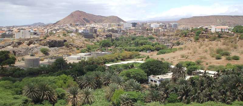
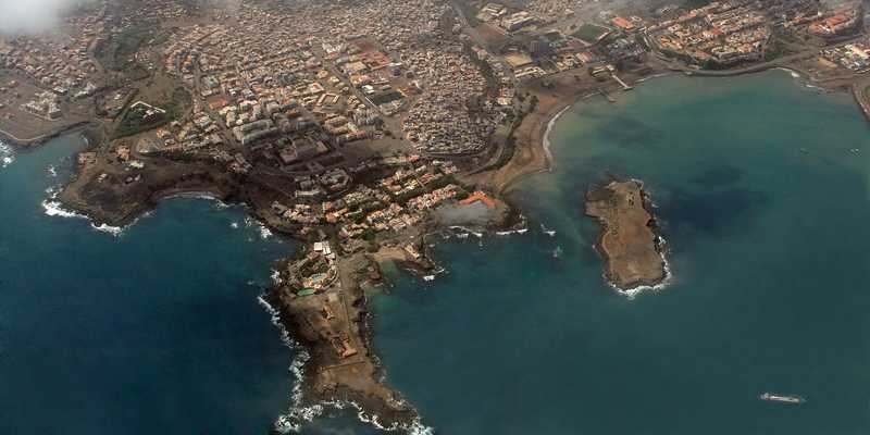
Cape Verde - CV - CPV - CPV - Africa
Last updated: January 05, 2026
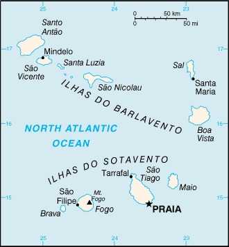
Cabo Verde Images
Cabo Verde Factbook Data
Diplomatic representation from the US
chief of mission: Ambassador Jennifer ADAMS (since 10 September 2024)
embassy: Rua Abilio Macedo 6, Praia
mailing address: 2460 Praia Place, Washington DC 20521-2460
telephone: [238] 260-8900
FAX: [238] 261-1355
email address and website:
PraiaConsular@state.gov
https://cv.usembassy.gov/
embassy: Rua Abilio Macedo 6, Praia
mailing address: 2460 Praia Place, Washington DC 20521-2460
telephone: [238] 260-8900
FAX: [238] 261-1355
email address and website:
PraiaConsular@state.gov
https://cv.usembassy.gov/
Age structure
0-14 years: 26.4% (male 80,973/female 80,129)
15-64 years: 67.2% (male 201,084/female 209,676)
65 years and over: 6.4% (2024 est.) (male 15,049/female 24,103)
15-64 years: 67.2% (male 201,084/female 209,676)
65 years and over: 6.4% (2024 est.) (male 15,049/female 24,103)
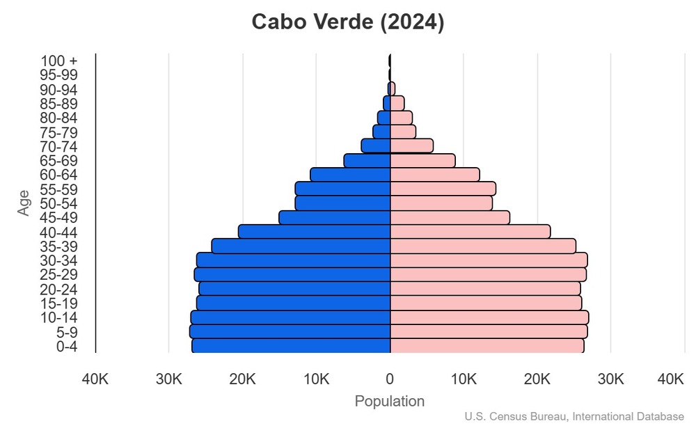
This is the population pyramid for Cabo Verde. A population pyramid illustrates the age and sex structure of a country's population and may provide insights about political and social stability, as well as economic development. The population is distributed along the horizontal axis, with males shown on the left and females on the right. The male and female populations are broken down into 5-year age groups represented as horizontal bars along the vertical axis, with the youngest age groups at the bottom and the oldest at the top. The shape of the population pyramid gradually evolves over time based on fertility, mortality, and international migration trends.
For additional information, please see the entry for Population pyramid on the Definitions and Notes page.
For additional information, please see the entry for Population pyramid on the Definitions and Notes page.
Geographic coordinates
16 00 N, 24 00 W
Sex ratio
at birth: 1.03 male(s)/female
0-14 years: 1.01 male(s)/female
15-64 years: 0.96 male(s)/female
65 years and over: 0.62 male(s)/female
total population: 0.95 male(s)/female (2024 est.)
0-14 years: 1.01 male(s)/female
15-64 years: 0.96 male(s)/female
65 years and over: 0.62 male(s)/female
total population: 0.95 male(s)/female (2024 est.)
Natural hazards
prolonged droughts; seasonal harmattan wind produces obscuring dust; volcanically and seismically active
volcanism: Fogo (2,829 m), which last erupted in 1995, is Cabo Verde's only active volcano
volcanism: Fogo (2,829 m), which last erupted in 1995, is Cabo Verde's only active volcano
Area - comparative
slightly larger than Rhode Island
Background
The Portuguese discovered and colonized the uninhabited islands of Cabo Verde in the 15th century; Cabo Verde subsequently became a trading center for African slaves and later an important coaling and resupply stop for whaling and transatlantic shipping. The fusing of European and various African cultural traditions is reflected in Cabo Verde’s Crioulo language, music, and pano textiles. After gaining independence in 1975, a one-party system was established and maintained until multi-party elections were held in 1990. Cabo Verde continues to sustain one of Africa's most stable democratic governments and relatively stable economies, maintaining a currency pegged first to the Portuguese escudo and then to the euro since 1998. Repeated droughts during the second half of the 20th century caused significant hardship and prompted heavy emigration. As a result, Cabo Verde's expatriate population -- concentrated in Boston, Massachusetts and Western Europe -- is greater than its domestic one.
Most Cabo Verdeans have both African and Portuguese antecedents. Cabo Verde’s population descends from its first permanent inhabitants in the late 15th-century -- a preponderance of West African slaves, a small share of Portuguese colonists, and even fewer Italians and Spaniards. Among the nine inhabited islands, population distribution is varied. The islands in the east are very dry and are home to the country's growing tourism industry. The more western islands receive more precipitation and support larger populations, but agriculture and livestock grazing have damaged their soil fertility and vegetation. For centuries, the country’s overall population size has fluctuated significantly, as recurring periods of famine and epidemics have caused high death tolls and emigration.
Most Cabo Verdeans have both African and Portuguese antecedents. Cabo Verde’s population descends from its first permanent inhabitants in the late 15th-century -- a preponderance of West African slaves, a small share of Portuguese colonists, and even fewer Italians and Spaniards. Among the nine inhabited islands, population distribution is varied. The islands in the east are very dry and are home to the country's growing tourism industry. The more western islands receive more precipitation and support larger populations, but agriculture and livestock grazing have damaged their soil fertility and vegetation. For centuries, the country’s overall population size has fluctuated significantly, as recurring periods of famine and epidemics have caused high death tolls and emigration.
Environmental issues
deforestation due to demand for firewood; water shortages; droughts; desertification; soil erosion; illegal beach sand extraction; overfishing
International environmental agreements
party to: Biodiversity, Climate Change, Climate Change-Kyoto Protocol, Climate Change-Paris Agreement, Comprehensive Nuclear Test Ban, Desertification, Endangered Species, Environmental Modification, Hazardous Wastes, Law of the Sea, Marine Dumping-London Convention, Nuclear Test Ban, Ozone Layer Protection, Ship Pollution, Wetlands
signed, but not ratified: none of the selected agreements
signed, but not ratified: none of the selected agreements
Military expenditures
0.6% of GDP (2024 est.)
0.6% of GDP (2023 est.)
0.5% of GDP (2022 est.)
0.5% of GDP (2021 est.)
0.5% of GDP (2020 est.)
0.6% of GDP (2023 est.)
0.5% of GDP (2022 est.)
0.5% of GDP (2021 est.)
0.5% of GDP (2020 est.)
Population below poverty line
35.2% (2015 est.)
note: % of population with income below national poverty line
note: % of population with income below national poverty line
Household income or consumption by percentage share
lowest 10%: 2.2% (2015 est.)
highest 10%: 32.3% (2015 est.)
note: % share of income accruing to lowest and highest 10% of population
highest 10%: 32.3% (2015 est.)
note: % share of income accruing to lowest and highest 10% of population
Exports - commodities
fish, refined petroleum, railway cargo containers, shellfish, garments (2023)
note: top five export commodities based on value in dollars
note: top five export commodities based on value in dollars
Exports - partners
Spain 46%, Portugal 9%, Togo 7%, Italy 7%, India 6% (2023)
note: top five export partners based on percentage share of exports
note: top five export partners based on percentage share of exports
Administrative divisions
22 municipalities (concelhos, singular - concelho); Boa Vista, Brava, Maio, Mosteiros, Paul, Porto Novo, Praia, Ribeira Brava, Ribeira Grande, Ribeira Grande de Santiago, Sal, Santa Catarina, Santa Catarina do Fogo, Santa Cruz, São Domingos, São Filipe, São Lourenco dos Orgaos, São Miguel, São Salvador do Mundo, São Vicente, Tarrafal, Tarrafal de São Nicolau
Agricultural products
sugarcane, tomatoes, coconuts, pulses, goat milk, milk, vegetables, bananas, cabbages, onions (2023)
note: top ten agricultural products based on tonnage
note: top ten agricultural products based on tonnage
Military and security forces
Cabo Verdean Armed Forces (FACV): National Guard (GN), Cabo Verde Coast Guard (Guardia Costeira de Cabo Verde, GCCV) (2025)
note: the National Police are under the Ministry of Internal Affairs
note: the National Police are under the Ministry of Internal Affairs
Budget
revenues: $453.182 million (2020 est.)
expenditures: $623.816 million (2020 est.)
note: central government revenues and expenses (excluding grants/extrabudgetary units/social security funds) converted to US dollars at average official exchange rate for year indicated
expenditures: $623.816 million (2020 est.)
note: central government revenues and expenses (excluding grants/extrabudgetary units/social security funds) converted to US dollars at average official exchange rate for year indicated
Capital
name: Praia
geographic coordinates: 14 55 N, 23 31 W
time difference: UTC-1 (4 hours ahead of Washington, DC, during Standard Time)
etymology: the earlier Portuguese name was Villa de Praia ("Village of the Beach"); it was shortened to Praia in 1974
geographic coordinates: 14 55 N, 23 31 W
time difference: UTC-1 (4 hours ahead of Washington, DC, during Standard Time)
etymology: the earlier Portuguese name was Villa de Praia ("Village of the Beach"); it was shortened to Praia in 1974
Imports - commodities
refined petroleum, aircraft, cars, fish, railway cargo containers (2023)
note: top five import commodities based on value in dollars
note: top five import commodities based on value in dollars
Climate
temperate; warm, dry summer; precipitation meager and erratic
Coastline
965 km
Constitution
history: previous 1981; latest effective 25 September 1992
amendment process: proposals require support of at least four fifths of the active National Assembly membership; amendment drafts require sponsorship of at least one third of the active Assembly membership; passage requires at least two-thirds majority vote by the Assembly membership; constitutional sections, including those on national independence, form of government, political pluralism, suffrage, and human rights and liberties, cannot be amended
amendment process: proposals require support of at least four fifths of the active National Assembly membership; amendment drafts require sponsorship of at least one third of the active Assembly membership; passage requires at least two-thirds majority vote by the Assembly membership; constitutional sections, including those on national independence, form of government, political pluralism, suffrage, and human rights and liberties, cannot be amended
Exchange rates
Cabo Verdean escudos (CVE) per US dollar -
Exchange rates:
101.922 (2024 est.)
101.805 (2023 est.)
104.863 (2022 est.)
93.218 (2021 est.)
96.796 (2020 est.)
Exchange rates:
101.922 (2024 est.)
101.805 (2023 est.)
104.863 (2022 est.)
93.218 (2021 est.)
96.796 (2020 est.)
Executive branch
chief of state: President Jose Maria Pereira NEVES (since 9 November 2021)
head of government: Prime Minister Jose Ulisses CORREIA e SILVA (since 22 April 2016)
cabinet: Council of Ministers appointed by the president on the recommendation of the prime minister
election/appointment process: president directly elected by absolute-majority popular vote in 2 rounds, if needed, for a 5-year term (eligible for a second term); prime minister nominated by the National Assembly and appointed by the president
most recent election date: 17 October 2021
election results:
2020: Jose Maria Pereira NEVES elected president; percent of vote - Jose Maria Pereira NEVES (PAICV) 51.7%, Carlos VEIGA (MPD) 42.4%, Casimiro DE PINA (independent) 1.8%, Fernando Rocha DELGADO (independent) 1.4%, Helio SANCHES (independent) 1.14%, Gilson ALVES (independent) 0.8%, Joaquim MONTEIRO (independent) 3.4%
2016: Jorge Carlos FONSECA reelected president; percent of vote - Jorge Carlos FONSECA (MPD) 74.1%, Albertino GRACA (independent) 22.5%, other 3.4%
expected date of next election: October 2026
Flag
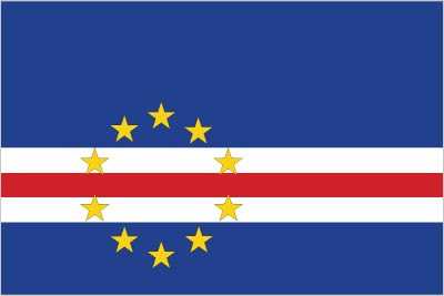
description: five unequal horizontal bands; the top band of blue is half the height of the flag; under it are three narrow bands of white, red, and white, and a bottom stripe of blue; a circle of 10 five-pointed yellow stars is centered on the red stripe and sits toward the left side of the flag
meaning: blue stands for the sea and sky; the stripes symbolize the country's formation through peace (white) and effort (red); the stars represent the 10 major islands
meaning: blue stands for the sea and sky; the stripes symbolize the country's formation through peace (white) and effort (red); the stars represent the 10 major islands
Independence
5 July 1975 (from Portugal)
Industries
food and beverages, fish processing, shoes and garments, salt mining, ship repair
Judicial branch
highest court(s): Supreme Court of Justice (consists of the chief justice and at least 7 judges and organized into civil, criminal, and administrative sections)
judge selection and term of office: judge appointments - 1 by the president of the republic, 1 elected by the National Assembly, and 3 by the Superior Judicial Council (SJC), a 16-member independent body chaired by the chief justice and includes the attorney general, 8 private citizens, 2 judges, 2 prosecutors, the senior legal inspector of the Attorney General's office, and a representative of the Ministry of Justice; chief justice appointed by the president of the republic from among peers of the Supreme Court of Justice and in consultation with the SJC; judges appointed for life
subordinate courts: appeals courts, first instance (municipal) courts; audit, military, and fiscal and customs courts
Land boundaries
total: 0 km
Land use
agricultural land: 19.6% (2023 est.)
arable land: 12.4% (2023 est.)
permanent crops: 1% (2023 est.)
permanent pasture: 6.2% (2023 est.)
forest: 12.4% (2023 est.)
other: 68% (2023 est.)
arable land: 12.4% (2023 est.)
permanent crops: 1% (2023 est.)
permanent pasture: 6.2% (2023 est.)
forest: 12.4% (2023 est.)
other: 68% (2023 est.)
Legal system
civil law system of Portugal
Legislative branch
legislature name: National Assembly (Assembleia Nacional)
legislative structure: unicameral
number of seats: 72 (all directly elected)
electoral system: proportional representation
scope of elections: full renewal
term in office: 5 years
most recent election date: 4/18/2021
parties elected and seats per party: Movement for Democracy (MpD) (38); African Party for the Independence of Cabo Verde (PAICV) (30); Union for an Independent Democratic Cape Verde (UCID) (4)
percentage of women in chamber: 44.4%
expected date of next election: April 2026
Literacy
total population: 88.5% (2024 est.)
male: 92.9% (2024 est.)
female: 84.1% (2024 est.)
male: 92.9% (2024 est.)
female: 84.1% (2024 est.)
Maritime claims
territorial sea: 12 nm
contiguous zone: 24 nm
exclusive economic zone: 200 nm
note: measured from claimed archipelagic baselines
contiguous zone: 24 nm
exclusive economic zone: 200 nm
note: measured from claimed archipelagic baselines
International organization participation
ACP, AfDB, AOSIS, AU, CD, CPLP, ECOWAS, FAO, G-77, IAEA, IBRD, ICAO, ICCt (signatory), ICRM, IDA, IFAD, IFC, IFRCS, ILO, IMF, IMO, Interpol, IOC, IOM, IPU, ITSO, ITU, ITUC (NGOs), MIGA, NAM, OIF, OPCW, UN, UNCTAD, UNESCO, UNIDO, Union Latina, UNWTO, UPU, WCO, WHO, WIPO, WMO, WTO
National holiday
Independence Day, 5 July (1975)
Nationality
noun: Cabo Verdean(s)
adjective: Cabo Verdean
adjective: Cabo Verdean
Natural resources
salt, basalt rock, limestone, kaolin, fish, clay, gypsum
Geography - note
strategic location 500 km from west coast of Africa near major north-south sea routes; one of four North Atlantic archipelagos that make up Macaronesia; the others are Azores (Portugal), Canary Islands (Spain), and Madeira (Portugal)
Economic overview
stable, middle-income, developing island economy; strong GDP growth led by tourism sector recovery; sustained poverty reduction through PEDS II development plan; high reliance on foreign remittances and aid to finance external debt
Political parties
African Party for Independence of Cabo Verde or PAICV
Democratic and Independent Cabo Verdean Union or UCID
Democratic Christian Party or PDC
Democratic Renewal Party or PRD
Movement for Democracy or MPD
Party for Democratic Convergence or PCD
Party of Work and Solidarity or PTS
Social Democratic Party or PSD
Democratic and Independent Cabo Verdean Union or UCID
Democratic Christian Party or PDC
Democratic Renewal Party or PRD
Movement for Democracy or MPD
Party for Democratic Convergence or PCD
Party of Work and Solidarity or PTS
Social Democratic Party or PSD
Suffrage
18 years of age; universal
Terrain
steep, rugged, rocky, volcanic
Government type
parliamentary republic
Country name
conventional long form: Republic of Cabo Verde
conventional short form: Cabo Verde
local long form: Republica de Cabo Verde
local short form: Cabo Verde
etymology: the name derives from the Cape Verde (Green Cape) peninsula on the Senegalese coast, the westernmost point of Africa and the nearest mainland to the islands
conventional short form: Cabo Verde
local long form: Republica de Cabo Verde
local short form: Cabo Verde
etymology: the name derives from the Cape Verde (Green Cape) peninsula on the Senegalese coast, the westernmost point of Africa and the nearest mainland to the islands
Location
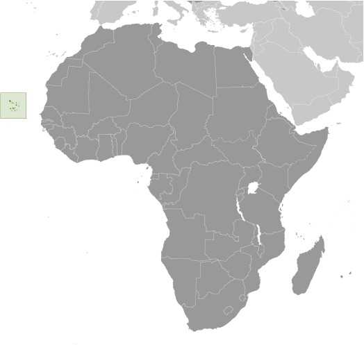
Western Africa, group of islands in the North Atlantic Ocean, west of Senegal
Map references
Africa
Irrigated land
35 sq km (2012)
Diplomatic representation in the US
chief of mission: Ambassador Jose Luis do Livramento MONTEIRO ALVES DE BRITO (since 23 December 2020)
chancery: 3415 Massachusetts Avenue NW, Washington, DC 20007
telephone: [1] (202) 965-6820
FAX: [1] (202) 965-1207
email address and website:
embassy.wdc@mnec.gov.cv
https://www.embcv-usa.gov.cv/
consulate(s) general: Boston
chancery: 3415 Massachusetts Avenue NW, Washington, DC 20007
telephone: [1] (202) 965-6820
FAX: [1] (202) 965-1207
email address and website:
embassy.wdc@mnec.gov.cv
https://www.embcv-usa.gov.cv/
consulate(s) general: Boston
Internet users
percent of population: 74% (2023 est.)
Internet country code
.cv
Refugees and internally displaced persons
stateless persons: 115 (2024 est.)
GDP (official exchange rate)
$2.768 billion (2024 est.)
note: data in current dollars at official exchange rate
note: data in current dollars at official exchange rate
Total renewable water resources
300 million cubic meters (2022 est.)
School life expectancy (primary to tertiary education)
total: 13 years (2018 est.)
male: 13 years (2018 est.)
female: 14 years (2018 est.)
male: 13 years (2018 est.)
female: 14 years (2018 est.)
Urbanization
urban population: 68% of total population (2023)
rate of urbanization: 1.83% annual rate of change (2020-25 est.)
rate of urbanization: 1.83% annual rate of change (2020-25 est.)
Broadcast media
state-run TV and radio network, plus a growing number of private broadcasters; Portuguese public TV and radio services for Africa are available; transmissions of a few international broadcasters are available (2019)
Drinking water source
improved:
urban: 93.2% of population (2022 est.)
rural: 82.9% of population (2022 est.)
total: 89.9% of population (2022 est.)
unimproved:
urban: 6.8% of population (2022 est.)
rural: 17.1% of population (2022 est.)
total: 10.1% of population (2022 est.)
urban: 93.2% of population (2022 est.)
rural: 82.9% of population (2022 est.)
total: 89.9% of population (2022 est.)
unimproved:
urban: 6.8% of population (2022 est.)
rural: 17.1% of population (2022 est.)
total: 10.1% of population (2022 est.)
National anthem(s)
title: "Cantico da Liberdade" (Song of Freedom)
lyrics/music: Amilcar Spencer LOPES/Adalberto Higino Tavares SILVA
history: adopted 1996
lyrics/music: Amilcar Spencer LOPES/Adalberto Higino Tavares SILVA
history: adopted 1996
This is an audio of the National Anthem for Cabo Verde. The national anthem is generally a patriotic musical composition - usually in the form of a song or hymn of praise - that evokes and eulogizes the history, traditions, or struggles of a nation or its people. National anthems can be officially recognized as a national song by a country's constitution or by an enacted law, or simply by tradition. Although most anthems contain lyrics, some do not.
Major urban areas - population
168,000 PRAIA (capital) (2018)
International law organization participation
has not submitted an ICJ jurisdiction declaration; accepts ICCt jurisdiction
Physician density
0.73 physicians/1,000 population (2023)
Hospital bed density
2 beds/1,000 population (2018 est.)
National symbol(s)
ten five-pointed yellow stars
GDP - composition, by end use
household consumption: 74.7% (2024 est.)
government consumption: 20.7% (2024 est.)
investment in fixed capital: 16% (2024 est.)
investment in inventories: 0% (2024 est.)
exports of goods and services: 41.9% (2024 est.)
imports of goods and services: -53.2% (2024 est.)
note: figures may not total 100% due to rounding or gaps in data collection
Dependency ratios
total dependency ratio: 48.8 (2024 est.)
youth dependency ratio: 39.2 (2024 est.)
elderly dependency ratio: 9.5 (2024 est.)
potential support ratio: 10.5 (2024 est.)
youth dependency ratio: 39.2 (2024 est.)
elderly dependency ratio: 9.5 (2024 est.)
potential support ratio: 10.5 (2024 est.)
Citizenship
citizenship by birth: no
citizenship by descent only: at least one parent must be a citizen of Cabo Verde
dual citizenship recognized: yes
residency requirement for naturalization: 5 years
citizenship by descent only: at least one parent must be a citizen of Cabo Verde
dual citizenship recognized: yes
residency requirement for naturalization: 5 years
Population distribution
among the nine inhabited islands, population distribution is variable; islands in the east are very dry and are only sparsely settled; the more southerly islands receive more precipitation and support larger populations; approximately half of the population lives on Sao Tiago Island, which is the location of the capital of Praia; Mindelo, on the northern island of Sao Vicente, also has a large urban population, as shown in this population distribution map
Electricity access
electrification - total population: 97.1% (2022 est.)
electrification - urban areas: 95.3%
electrification - rural areas: 96.9%
electrification - urban areas: 95.3%
electrification - rural areas: 96.9%
Civil aircraft registration country code prefix
D4
Sanitation facility access
improved:
urban: 95.6% of population (2022 est.)
rural: 77.8% of population (2022 est.)
total: 89.8% of population (2022 est.)
unimproved:
urban: 4.4% of population (2022 est.)
rural: 22.2% of population (2022 est.)
total: 10.2% of population (2022 est.)
urban: 95.6% of population (2022 est.)
rural: 77.8% of population (2022 est.)
total: 89.8% of population (2022 est.)
unimproved:
urban: 4.4% of population (2022 est.)
rural: 22.2% of population (2022 est.)
total: 10.2% of population (2022 est.)
Ethnic groups
Creole (Mulatto) 71%, African 28%, European 1%
Religions
Roman Catholic 72.5%, Protestant 4% (includes Adventist 1.9%, Nazarene 1.8%, Assembly of God 0.2%, God is Love 0.1%), Christian Rationalism 1.7%, Muslim 1.3%, Jehovah's Witness 1.2%, Church of Jesus Christ 1%, other Christian 1.3%, other 1.2%, none 15.6%, no response 0.4% (2021 est.)
Languages
Portuguese (official), Crioulo (a Portuguese-based creole language with two main dialects)
Imports - partners
Portugal 29%, Saudi Arabia 11%, Netherlands 9%, Spain 8%, China 7% (2023)
note: top five import partners based on percentage share of imports
note: top five import partners based on percentage share of imports
Elevation
highest point: Mt. Fogo (a volcano on Fogo Island) 2,829 m
lowest point: Atlantic Ocean 0 m
lowest point: Atlantic Ocean 0 m
Health expenditure
6.9% of GDP (2021)
16.1% of national budget (2022 est.)
16.1% of national budget (2022 est.)
Military and security service personnel strengths
the FACV has approximately 1,000-1,500 active personnel (2025)
Military equipment inventories and acquisitions
the FACV has a limited amount of mostly dated or secondhand equipment, largely from China, some European countries, and the former Soviet Union (2025)
Total water withdrawal
municipal: 155.895 million cubic meters (2022)
industrial: 5.614 million cubic meters (2022)
agricultural: 103.217 million cubic meters (2022)
industrial: 5.614 million cubic meters (2022)
agricultural: 103.217 million cubic meters (2022)
Waste and recycling
municipal solid waste generated annually: 132,600 tons (2024 est.)
percent of municipal solid waste recycled: 17.4% (2022 est.)
percent of municipal solid waste recycled: 17.4% (2022 est.)
Trafficking in persons
tier rating: Tier 2 Watch List — Cabo Verde did not demonstrate overall increasing efforts to eliminate trafficking compared with the previous reporting period and was downgraded to Tier 2 Watch List; for more details, go to: https://www.state.gov/reports/2025-trafficking-in-persons-report/cabo-verde/
Military - note
the FACV is responsible for external defense; it also has an internal security role in collaboration with the police if required; its duties include monitoring and patrolling the country's air and maritime spaces, participating in training exercises, conducting search and rescue, countering narcotics and other forms of illicit trafficking, and supporting the police and civil society (2025)
National heritage
total World Heritage Sites: 1 (cultural)
selected World Heritage Site locales: Cidade Velha; Historic Center of Ribeira Grande
selected World Heritage Site locales: Cidade Velha; Historic Center of Ribeira Grande
Electricity generation sources
fossil fuels: 71.1% of total installed capacity (2023 est.)
solar: 14.2% of total installed capacity (2023 est.)
wind: 14.6% of total installed capacity (2023 est.)
solar: 14.2% of total installed capacity (2023 est.)
wind: 14.6% of total installed capacity (2023 est.)
Petroleum
refined petroleum consumption: 5,000 bbl/day (2023 est.)
Currently married women (ages 15-49)
45% (2021 est.)
Remittances
12.1% of GDP (2024 est.)
12.5% of GDP (2023 est.)
14% of GDP (2022 est.)
note: personal transfers and compensation between resident and non-resident individuals/households/entities
12.5% of GDP (2023 est.)
14% of GDP (2022 est.)
note: personal transfers and compensation between resident and non-resident individuals/households/entities
Child marriage
women married by age 15: 1.8% (2018)
women married by age 18: 8.4% (2018)
men married by age 18: 1.5% (2018)
women married by age 18: 8.4% (2018)
men married by age 18: 1.5% (2018)
Ports
total ports: 2 (2024)
large: 0
medium: 0
small: 1
very small: 1
ports with oil terminals: 1
key ports: Porto da Praia, Porto Grande
large: 0
medium: 0
small: 1
very small: 1
ports with oil terminals: 1
key ports: Porto da Praia, Porto Grande
National color(s)
blue, white, red, yellow
National coat of arms
adopted in 1992, the coat of arms features the national symbol of ten stars that represent the country’s islands; the stylized torch and triangle at the center of the circle symbolize freedom and national unity, and the three blue lines represent the ocean and sky; the name of the country is written in Portuguese, the official language; the plumbob at the top of the circle -- used in construction to make accurate vertical lines -- represents justice, righteousness, and truth; the chain links symbolize a commitment to the people and their well-being
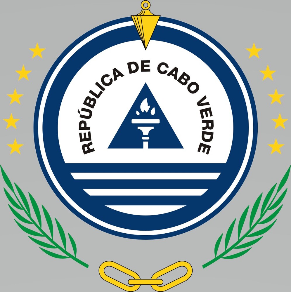
Adopted in 1992, the coat of arms of Cabo Verde features the national symbol of ten stars that represent the country’s islands. The stylized torch and triangle at the center of the circle symbolize freedom and national unity, and the three blue lines represent the ocean and sky. The name of the country is written in Portuguese, the official language. The plumbob at the top of the circle -- used in construction to make accurate vertical lines -- represents justice, righteousness, and truth. The chain links symbolize a commitment to the people and their well-being.
Particulate matter emissions
27.4 micrograms per cubic meter (2019 est.)
Labor force
224,500 (2024 est.)
note: number of people ages 15 or older who are employed or seeking work
note: number of people ages 15 or older who are employed or seeking work
Youth unemployment rate (ages 15-24)
total: 28.2% (2024 est.)
male: 24.6% (2024 est.)
female: 33.8% (2024 est.)
note: % of labor force ages 15-24 seeking employment
male: 24.6% (2024 est.)
female: 33.8% (2024 est.)
note: % of labor force ages 15-24 seeking employment
Debt - external
$1.385 billion (2023 est.)
note: present value of external debt in current US dollars
note: present value of external debt in current US dollars
Maternal mortality ratio
40 deaths/100,000 live births (2023 est.)
Reserves of foreign exchange and gold
$783.106 million (2024 est.)
$837.881 million (2023 est.)
$729.566 million (2022 est.)
note: holdings of gold (year-end prices)/foreign exchange/special drawing rights in current dollars
$837.881 million (2023 est.)
$729.566 million (2022 est.)
note: holdings of gold (year-end prices)/foreign exchange/special drawing rights in current dollars
Unemployment rate
11.9% (2024 est.)
12% (2023 est.)
12.3% (2022 est.)
note: % of labor force seeking employment
12% (2023 est.)
12.3% (2022 est.)
note: % of labor force seeking employment
Population
total: 611,014 (2024 est.)
male: 297,106
female: 313,908
male: 297,106
female: 313,908
Carbon dioxide emissions
714,000 metric tonnes of CO2 (2023 est.)
from petroleum and other liquids: 714,000 metric tonnes of CO2 (2023 est.)
from petroleum and other liquids: 714,000 metric tonnes of CO2 (2023 est.)
Area
total : 4,033 sq km
land: 4,033 sq km
water: 0 sq km
land: 4,033 sq km
water: 0 sq km
Taxes and other revenues
18.4% (of GDP) (2020 est.)
note: central government tax revenue as a % of GDP
note: central government tax revenue as a % of GDP
Real GDP (purchasing power parity)
$5.2 billion (2024 est.)
$4.848 billion (2023 est.)
$4.6 billion (2022 est.)
note: data in 2021 dollars
$4.848 billion (2023 est.)
$4.6 billion (2022 est.)
note: data in 2021 dollars
Airports
10 (2025)
Telephones - mobile cellular
total subscriptions: 590,000 (2023 est.)
subscriptions per 100 inhabitants: 99 (2022 est.)
subscriptions per 100 inhabitants: 99 (2022 est.)
Gini Index coefficient - distribution of family income
42.4 (2015 est.)
note: index (0-100) of income distribution; higher values represent greater inequality
note: index (0-100) of income distribution; higher values represent greater inequality
Inflation rate (consumer prices)
1% (2024 est.)
3.7% (2023 est.)
7.9% (2022 est.)
note: annual % change based on consumer prices
3.7% (2023 est.)
7.9% (2022 est.)
note: annual % change based on consumer prices
Current account balance
$101.072 million (2024 est.)
-$64.439 million (2023 est.)
-$78.271 million (2022 est.)
note: balance of payments - net trade and primary/secondary income in current dollars
-$64.439 million (2023 est.)
-$78.271 million (2022 est.)
note: balance of payments - net trade and primary/secondary income in current dollars
Real GDP per capita
$9,900 (2024 est.)
$9,300 (2023 est.)
$8,900 (2022 est.)
note: data in 2021 dollars
$9,300 (2023 est.)
$8,900 (2022 est.)
note: data in 2021 dollars
Broadband - fixed subscriptions
total: 38,000 (2023 est.)
subscriptions per 100 inhabitants: 7 (2023 est.)
subscriptions per 100 inhabitants: 7 (2023 est.)
Tobacco use
total: 9.8% (2025 est.)
male: 15.3% (2025 est.)
female: 4.5% (2025 est.)
male: 15.3% (2025 est.)
female: 4.5% (2025 est.)
Obesity - adult prevalence rate
11.8% (2016)
Energy consumption per capita
19.999 million Btu/person (2023 est.)
Electricity
installed generating capacity: 200,000 kW (2023 est.)
consumption: 400 million kWh (2023 est.)
transmission/distribution losses: 106 million kWh (2023 est.)
consumption: 400 million kWh (2023 est.)
transmission/distribution losses: 106 million kWh (2023 est.)
Merchant marine
total: 44 (2023)
by type: general cargo 14, oil tanker 2, other 28
by type: general cargo 14, oil tanker 2, other 28
Children under the age of 5 years underweight
2.2% (2018 est.)
Imports
$1.473 billion (2024 est.)
$1.428 billion (2023 est.)
$1.31 billion (2022 est.)
note: balance of payments - imports of goods and services in current dollars
$1.428 billion (2023 est.)
$1.31 billion (2022 est.)
note: balance of payments - imports of goods and services in current dollars
Exports
$1.158 billion (2024 est.)
$972.636 million (2023 est.)
$851.907 million (2022 est.)
note: balance of payments - exports of goods and services in current dollars
$972.636 million (2023 est.)
$851.907 million (2022 est.)
note: balance of payments - exports of goods and services in current dollars
Telephones - fixed lines
total subscriptions: 60,000 (2023 est.)
subscriptions per 100 inhabitants: 12 (2023 est.)
subscriptions per 100 inhabitants: 12 (2023 est.)
Alcohol consumption per capita
total: 4.7 liters of pure alcohol (2019 est.)
beer: 2.28 liters of pure alcohol (2019 est.)
wine: 1.82 liters of pure alcohol (2019 est.)
spirits: 0.6 liters of pure alcohol (2019 est.)
other alcohols: 0 liters of pure alcohol (2019 est.)
beer: 2.28 liters of pure alcohol (2019 est.)
wine: 1.82 liters of pure alcohol (2019 est.)
spirits: 0.6 liters of pure alcohol (2019 est.)
other alcohols: 0 liters of pure alcohol (2019 est.)
Life expectancy at birth
total population: 74.3 years (2024 est.)
male: 72 years
female: 76.7 years
male: 72 years
female: 76.7 years
Real GDP growth rate
7.3% (2024 est.)
5.4% (2023 est.)
15.8% (2022 est.)
note: annual GDP % growth based on constant local currency
5.4% (2023 est.)
15.8% (2022 est.)
note: annual GDP % growth based on constant local currency
Industrial production growth rate
4.4% (2024 est.)
note: annual % change in industrial value added based on constant local currency
note: annual % change in industrial value added based on constant local currency
GDP - composition, by sector of origin
agriculture: 4.7% (2024 est.)
industry: 10.5% (2024 est.)
services: 69.4% (2024 est.)
note: figures may not total 100% due to non-allocated consumption not captured in sector-reported data
industry: 10.5% (2024 est.)
services: 69.4% (2024 est.)
note: figures may not total 100% due to non-allocated consumption not captured in sector-reported data
Education expenditure
4.3% of GDP (2023 est.)
13.4% national budget (2024 est.)
13.4% national budget (2024 est.)
Military service age and obligation
17 years of age for voluntary service (with parental consent); 18-35 years of age for selective compulsory service (14-month service obligation) (2025)
Gross reproduction rate
1.02 (2025 est.)
Net migration rate
-0.56 migrant(s)/1,000 population (2025 est.)
Median age
total: 29.3 years (2025 est.)
male: 27.9 years
female: 29.6 years
male: 27.9 years
female: 29.6 years
Total fertility rate
2.08 children born/woman (2025 est.)
Infant mortality rate
total: 21.9 deaths/1,000 live births (2025 est.)
male: 26.3 deaths/1,000 live births
female: 18.4 deaths/1,000 live births
male: 26.3 deaths/1,000 live births
female: 18.4 deaths/1,000 live births
Death rate
5.73 deaths/1,000 population (2025 est.)
Birth rate
17.51 births/1,000 population (2025 est.)
Population growth rate
1.12% (2025 est.)

